Top Five Trekking Trails of Tamil Nadu

Five Beautiful Forest Hikes To Explore the Beauty and Culture of Tamil Nadu
Travellers visit the Southern state of Tamil Nadu in India to experience the cultural heritage and see grand temples. Nonetheless, we are glad to add here that the state can also offer you some of the best treks in South India. So, if you like trekking, try at least one of the five trails listed below to see how beautiful the mountains and landscapes of Tamil Nadu are. This blog post will cover the top five Tamil Nadu treks we recommend you do for an exhilarating experience.
1. Puliancholai Trek
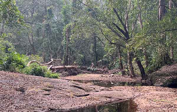
Puliancholai is a picturesque hill station near Trichy in central Tamil Nadu and is blessed with forests, waterfalls, and hiking trails. The trek is one of the most popular treks in Tamil Nadu, and it takes you through good forests, scenic waterfalls, and stunning landscapes. See it on Google Maps.
a. Location and Elevation
The Puliancholai Trek is near the historical city of Trichy in central Tamil Nadu. The trail goes up to an elevation of up to 1,300 meters above sea level.
b. Starting Point of Puliancholai Trek
The starting point of the Puliancholai Trek is the Puliancholai Forest Check Post.
c. How to Reach the Starting Point
To reach the Puliancholai Forest Check Post, you can take a bus or a taxi from Trichy. Thrichy is well-connected to all major cities in Tamil Nadu, including Chennai, Madurai, Coimbatore, and Salem. If you arrive by air, you can hire a cab, take a bus from Trichy Airport, or train from the railway station (80 kilometres/50 miles) to the Puliancholai Forest Check Post.
d. Important Views and Sights of Puliancholai Trek
The Puliancholai Trek takes you through forests, waterfalls, and stunning landscapes. You will also see the famous Agaya Gangai Waterfalls, a popular tourist attraction in Tamil Nadu. The waterfall is amid lush greenery and offers a breathtaking view.
e. Difficulty and Duration of the Puliancholai Trek
The Puliancholai Trek is moderate-difficult; you can complete it in a day. The trail is about 5 kilometres/3.1 miles long. You can complete it in three hours if you are a healthy hiker.
f. The Best Time for the Trek
The best time to take up the Puliancholai Trek is from October to March. The weather during this time is pleasant, and the views are stunning. You can do this trek year-round, but the rainy season between June and September can be difficult to climb as the trail will be slippery.
2. Tada Fall Trek
The Tada Falls Trek is all about visiting the Tada Falls. Though the fall is situated in the Chittoor district of Andhra Pradesh, the place is easily accessible from Chennai, Tamil Nadu. The Tada trek is relatively easy and can be completed in a day. See it on Google Map
a. Location and Elevation of Tada Fall Trek
The Tada Falls are located in the Chittoor district of Andhra Pradesh but are accessible from Chennai, Tamil Nadu. The waterfall is around 30 meters tall, and you can see some of the best views of the waterfall from the trail.
b. Starting PointPoint of Tada Fall Frail.
The starting point of the Tada Falls Trek is the village of Varadaiahpalem, which is at the foot of the hills and is surrounded by forests.
c. How to Reach the Starting Point.
The nearest airport to Varadaiahpalem is Chennai International Airport, located around 80 kilometres/50 miles away. The nearest railway station is in Sullurpeta, around 15 kilometres/9.3 miles away. From Sullurpeta, you can take a taxi or a bus to reach Varadaiahpalem.
d. Important Views and Sights of the Tada Fall Trek
The Tada Falls is the highlight of the trek. The trail takes you through woods, meadows, and breathtaking landscapes.
e. Difficulty and Duration of the Tada Fall Trek
The Tada Falls Trek is a day trek. The trail is around 10 kilometres/6.2 miles long and can easily take 4-5 hours for an adult to complete.
f. The Best Time for the Trek
The best time to take up the Tada Falls Trek is from November to March. The weather during this time is pleasant, and the waterfall is also good.
When the summer peaks flow of water in the fall will subside.
3. Kottagiri Trek
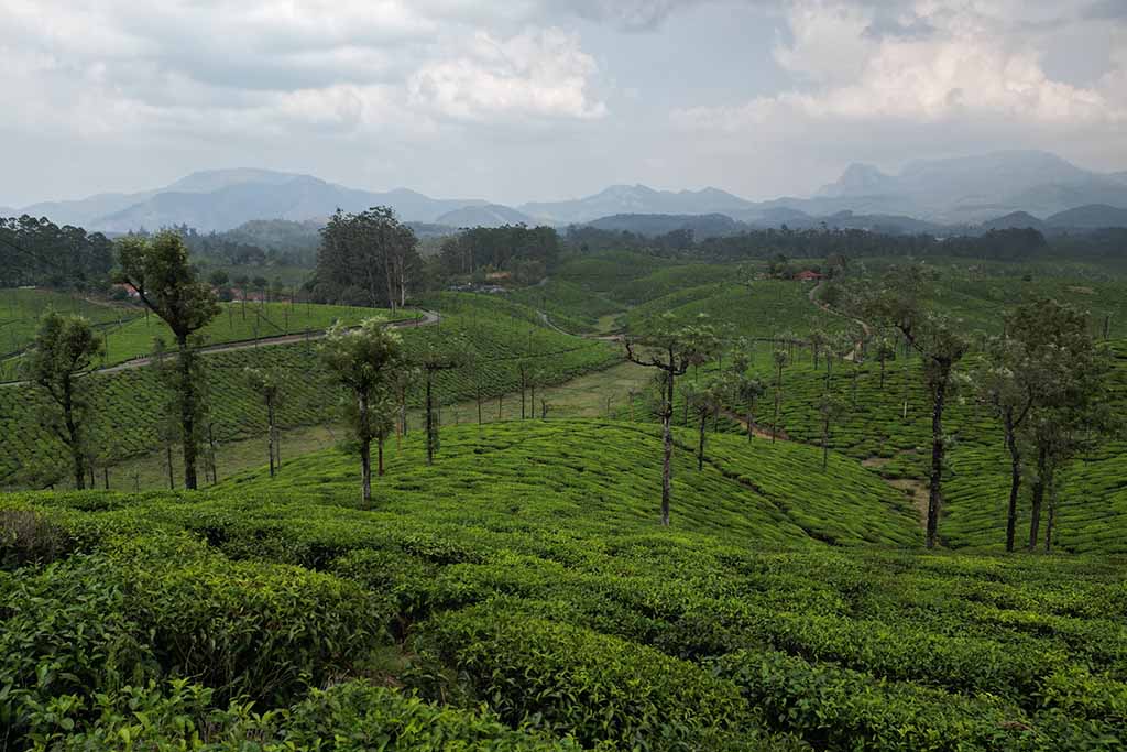
The Kottagiri Trek is a beautiful trek that takes you to the top of the Kottagiri hills in Nilgiries. The Kottagiri Hills are in the Nilgiri district of Tamil Nadu, home to the most popular hill stations in south India. Kottagiri offers some of the most stunning views of the surrounding hills and valleys. The trek is moderate and can be completed in a day. See it on Google Maps.
a. Location and Elevation
The Kottagiri hills are in the Nilgiri district of Tamil Nadu. The highest PointPoint of the Kottagiri Hills is around 2,140 meters above sea level.
b. Starting Point of Kottagiri Trek
The starting point of the Kottagiri Trek is the village of Kottagiri. Kottagiri is a tourist town that is easy to reach and locate.
c. How to Reach the Starting Point
The nearest airport to Kottagiri is Coimbatore International Airport, located around 70 kilometres/43 miles away. The nearest railway station is in Mettupalayam, around 35 kilometres/22 miles away. You can take a taxi or a bus from Mettupalayam to Kottagiri.
d. Important Views and Sights of the Trek
The Kottagiri Trek offers some of the most beautiful views of the Nilgiri hills and valleys. The trail goes through tea gardens, beautiful hills, and breathtaking valleys. You will also see the Kottagiri Viewpoint, which offers panoramic views of Ooty hills and valleys.
e. Difficulty and Duration of the Kottagiri Trek
The Kottagiri Trek is moderate and can be completed in a day. However, the trek can take roughly 5 to 6 hours as it is about 12 kilometres (7.5 miles) long.
f. The Best Time for the Trek
The best time to take up this trek is September to March. The weather during this time is pleasant, and the views are stunning.
4. Kodiakanal-Perumal Peak Trek
The Kodiakanal-Perumal Peak Trek is a beautiful trek that takes you to the top of the Perumal Peak. The Perumal Peak is the highest in the Kodaikanal hills, offering some of the most enticing views of the surrounding hills and valleys. The trek is moderate to difficult and can be completed in a day. See it on Google Maps.
a. Location and Elevation
The Perumal Peak is in the Kodaikanal hills in the Dindigul district of Tamil Nadu. The highest point of the Perumal Peak is around 2,440 meters above sea level.
b. Starting PointPoint
The starting point of the Kodiakanal-Perumal Peak Trek is the town of Kodiakanal. It is another famous hill station like Ooty in the Western Ghats.
c. How to Reach the Starting Point
The nearest airport to Kodaikanal is Madurai International Airport, located around 120 kilometres/75.5 miles away. The nearest railway station is Kodai Road, around 80 kilometres/49.7 miles away. You can take a taxi or bus from Kodai Road to Kodaikanal.
d. Important Views and Sights of the Trek
The Views you get while doing Kodiakanal-Perumal Peak Trek are mesmerising. During this hike, you will see shola forests, beautiful meadows, emerald tea gardens etc. You will also see the Dolphin’s Nose viewpoint, which offers excellent views of the surrounding hills and valleys.
e. Difficulty and Duration of the Kodaikanal- Perumal Peak Trek
The Kodiakanal-Perumal Peak Trek is moderate to strenuous, and you can complete it in a day. The trek is around 10 kilometres/6.2 miles long and can take approximately 6-7 hours to complete.
f. The Best Time for the Trek
The best time to take up the Kodiakanal-Perumal Peak Trek is from October to April. The weather during this time is pleasant, and the views are stunning.
5. Gingee Fort Trek

The Gingee Fort Trek is a beautiful trek that takes you to the top of the Gingee Fort. The Gingee Fort is a historical fort in the Villupuram district of Tamil Nadu. The hike is moderate and can be completed in a day. The Gingee Fort Trek is popular among history buffs and nature lovers. See it on Google Maps.
a. Location and Elevation
The Gingee Fort is in the Villupuram district of Tamil Nadu. The highest PointPoint of the fort is around 800 meters above sea level.
b. Starting PointPoint of Gingee Fort Trek
The starting point of the Gingee Fort Trek is the town of Gingee, which is at the base of the fort, and lush green forests surround it.
c. How to Reach the Starting Point
The nearest airport to Gingee is Chennai International Airport, which is around 150 kilometres/93 miles away. The nearest railway station is in Villupuram, approximately 50 kilometres/31 miles away. From
Villupuram, you can take a taxi or a bus to reach Gingee.
d. Important Views and Sights of the Gingee Trek
The Gingee Fort Trek offers some of the most stunning views of the surrounding hills and valleys. You will also see the historic Gingee Fort, a popular tourist attraction in Tamil Nadu.
e. Difficulty and Duration of the Gingee Trek
The Gingee Fort Trek is moderate and can be completed in a day. The trek is around 6 kilometres/3.7 miles long and takes about 3-4 hours to complete.
f. The Best Time for the Gingee Trek
The best time to take up the Gingee Fort Trek is from November to February. The weather during this time is pleasant, and the views are stunning.
Tamil Nadu offers some of the most stunning trekking destinations in India. The Koli Hill Trek, Tada Falls Trek, Kottagiri Trek, Kodiakanal-Perumal Peak Trek, and Gingee Fort Trek are some of the best treks in Tamil Nadu that you should not miss. Before taking up any of these treks, you must ensure that you are physically fit and have no health issues. You should also carry enough water, snacks, and sunscreen with you.
Keep Hiking!