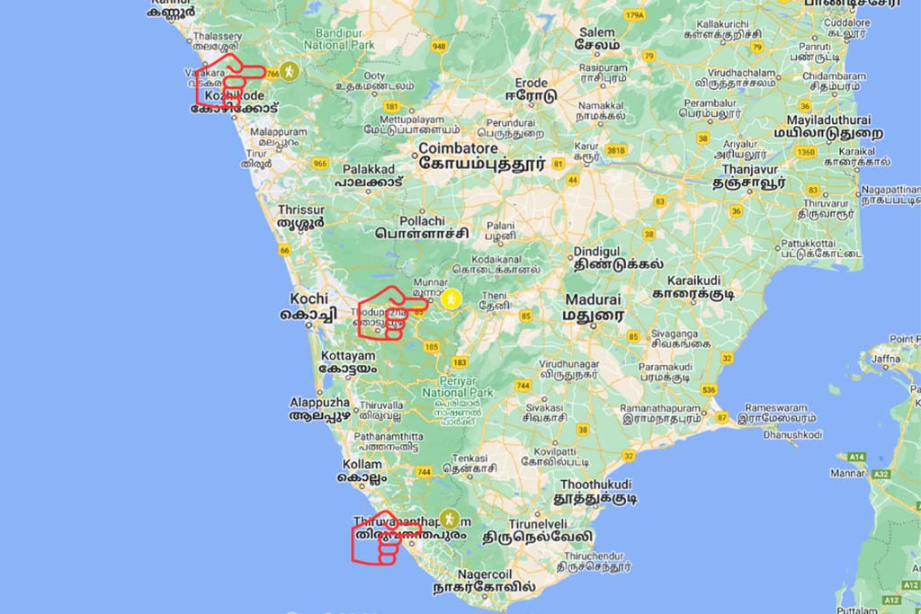
Top Trekking Places In Kerala
Three Top Hiking Trails In Kerala
Kerala has stunning western ghats mountain ranges running through its eastern borders. It offers nature lovers and adventure travellers some of the best hiking opportunities. This blog discusses the Agastyakoodam Trek, Chembra Trail and the famous Meesapulimala Trek. It includes where it is, how to get there, the main intersections, how difficult it is, how long it takes, the sights you’ll see the way, safety tips, and advice for hikers.
1. Chembra Trek: Hiking The Wayanad Hills, North Kerala
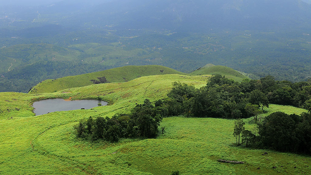
Chembra Peak, a natural wonder and one most well-liked trekking locations in Kerala, is in the heart of the Western Ghats. The highest point is 2,100 metres above sea level and provides stunning views of the valleys and hills in the nearby area. Any nature lover or trekker visiting Kerala must consider doing Chembra Peak, especially if they explore northern Kerala.
The location of Chembra Peak
Chembra Peak is in the Wayanad district in the northern part of Kerala. Wayanad is a plantation district, and a large portion lies in the well-forested Western Ghat mountain ranges. This ancient range is one of the world’s eight “hottest hotspots” of biological diversity and a UNESCO World Heritage Site. The peak is conveniently located close to Kalpetta and is reachable by road.
Starting Point Point
A small town called Meppady, located about 8 km from the peak, is where the Trek to Chembra Peak begins. Road access is available from Kalpetta or Sulthan Bathery to Meppady. The walk to Chembra Peak from Meppady is about 4 km long and takes 3 to 4 hours to complete.
Primary Intersecting Points
There are three main sections to the walk to Chembra Peak. First, you will pass through tea plantations and grasslands during the Trek’s initial gentle slope. The Trek’s second leg involves a steep ascent through forested and rocky terrain. The hardest part of the Trek requires a certain level of physical fitness. To reach the peak, hikers must ascend a steep, rocky slope in the final section of the journey.
Difficulty Level
The ascent of Chembra Peak is moderately challenging. The steep climb through forested areas and rocky terrain can be challenging for some trekkers. But anyone with a reasonable level of physical fitness can complete the Trek with the correct planning and direction.
Distance
The walk to Chembra Peak is about 4 km long and gains about 1,000 metres in altitude. The distance might seem pretty close, but the ascent through the thick forests and rocky terrain can be rugged.
Time Spent
The walk to Chembra Peak typically takes 3–4 hours to complete. However, the time required may change depending on the weather and the trekkers’ physical condition.
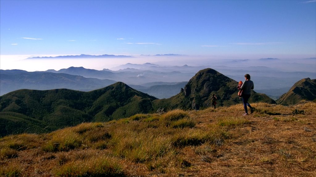
Sights and experiences
The view of surrounding hills and valleys is breathtaking from the climb to Chembra Peak. Trekkers will pass through tea plantations, grasslands, and thick forests. The trail’s highlight is the heart-shaped lake about halfway up the peak. Before continuing the ascent to the mountain, stop at the lake, a popular location for photography.
Chembra Peak stands out due to its heart-shaped lake, which is unusual for the Western Ghats. It is a revered lake by the local tribal communities and is thought to have formed due to a meteorite impact.
2. The Agastyakoodam Trek: Exciting Adventure in the South of Kerala.
The Agastyakoodam Trek in Kerala is a must-do experience if you enjoy trekking through the forest and are an adventure enthusiast. This Trek is one of South India’s most challenging and thrilling treks, enriching the experience. The Trek leads to one of the highest peaks of Kerala’s Western Ghats, encircled by verdant forests, waterfalls, and breathtaking vistas.
Location
Agastyakoodam Trek is in the Neyyar Wildlife Sanctaury. The Sanctuary is a well-liked tourist destination. It is close to Thrivurvanthapuram and Kovalam. Hence if you are visiting South Kerala, Agastyakoodam is the best trekking option.
Starting Point Point
Agastyakoodam Trek begins from the Bonacaud Forest Station area. The Bonacaud village is the base camp of the Agastyakoodam peak. The journey starts in this village. Bonacaud is roughly 50 kilometres from Thiruvananthapuram, the state capital.
How to Get to Bonacaud
Trivandrum (TRV), aka Thiruvananthapuram, about 60 km from Bonacaud, is the closest airport if you arrive by air. You can take a bus or a taxi to reach Bonacaud village. The nearest railway station is also Thiruvananthapuram, which is well-connected with the main cities in India. Again, you can take a bus or a taxi from the railway station to Bonacaud.
Principal Points of Intersection
The Agastyakoodam Trek is a circular route, and the Agastyakoodam Peak and Agastyakoodam Falls are its two main intersections. The Trek’s highest peak point provides a breathtaking view of the hills and forests below. On the trek route is a stunning waterfall called Agastyakoodam Falls, an excellent spot to stop and relax.
Difficulty Level
The Agastyakoodam Trek is a challenging trek best suited for seasoned hikers. The Trek entails scaling steep hills, navigating rocky terrain, and traversing forested areas. If you are not hiking in peak summer, you must expect rain in the afternoon, which can make your plans messy. So being physically and mentally prepared is critical before beginning this Trek.
Time and Distance
The Agastyakoodam Trek has a total length of about 28 km, and you should aim to complete it in two to three days. The Trek is circular, and there are two possible directions to travel the distance: clockwise or anticlockwise.
Views and Experience
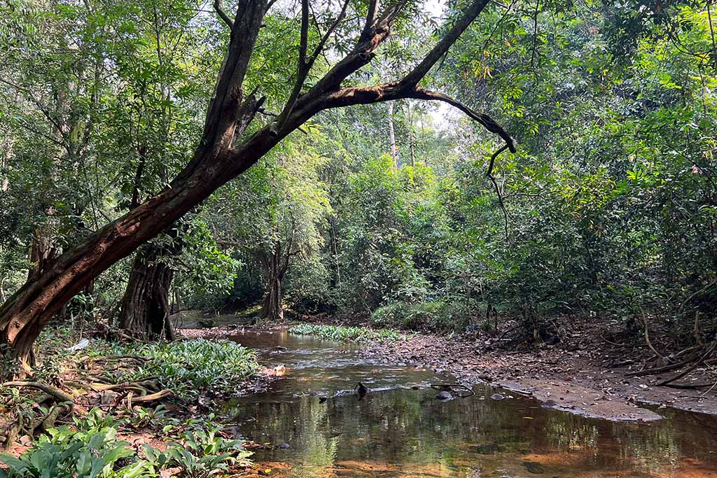
Trekkers can enjoy a distinctive and exhilarating experience at the Agastyakoodam Trek. The Trek passes through thick forests, waterfalls, and streams to give you enticing views of western ghats, wild animals, birds, plants, and trees. The peak of the Agastyakoodam is an excellent location to view the sunrise and sunset and provides a panoramic view of the Western Ghats.
3. Meesapulimala Trek: A Journey to the Top of Western Ghats from Central Kerala.
As one of the highest peaks in the Western Ghats, Meesapulimala is an ideal trekking route in central Kerala. The Trek to Meesapulimala is challenging and offers the best of the views of Nigiri Hills and surrounding hills and valleys. You must go through the Kerala Tourism Development Corporation (KDTC) for the trekking packages. Another option is to work with a tour operator who can make all arrangements for you.
Location of the Trek
Meesapulimala in Munnar Hills of Western Ghats, in Kerala, India. The peak is 8,661 feet (2,640 meters), the second-highest mountain in the Western Ghats after Anamudi. The Trek to Meesapulimala is one of the most popular treks in the region and attracts thousands of visitors every year.
Starting Point of the Trek
The starting point of the Meesapulimala trek is Munnar. Next, arrange a Jeep to the base camp vial Mattupetty and Aruvikkal tea estates. The village is about 15 kilometres from Munnar, amid tea estates and forested hills. From Silent Valley, the Trek takes you through dense forests, grasslands, and rugged terrain, before reaching the summit of Meesapulimala.
How to Reach the Starting Point
Base camp is well-connected by road from Munnar. The nearest airport is Cochin International Airport (COK), which is about 130 kilometres away from Munnar. If you are coming via train, you can get down at Angamali or Alway and take a taxi or bus to Munnar.
Intersecting Points
The Meesapulimala trek intersects with several other popular hikes and trails in the region, including the Rhodo Valley trek and the Kolukkumalai tea estate trek. The Rhodo Valley trek takes you through a beautiful valley filled with rhododendron flowers, while the Kolukkumalai tea estate trek offers stunning views of the tea plantations and the surrounding hills.
Difficulty Level and Distances
The Meesapulimala trek is moderately complex and requires reasonable physical fitness and stamina. It usually takes 7-8 hours to complete this 15-kilometre hiking trail. However, the time required will change depending on your physical condition and how quickly you walk.
Duration of the Trek
Start the Trek in the wee hours to avoid the heat and reach the summit in time for sunrise. The hike usually takes around 7-8 hours, including breaks for rest and food. You must carry enough snacks and water as no shops or restaurants are nearby. If you wish to see the sunrise, which we strongly recommend, you must start your hike at about midnight to reach the top on time. KTDC has accommodations and other facilities for trekkers at the base camp.
Sights and Experiences
The Meesapulimala trek offers a unique and unforgettable experience for trekkers. The Trek offers breathtaking views of the hills, tea gardens, and valleys as it passes through shola forests, grasslands, and cliffs. Watching the sunrise can be an unforgettable experience for anyone.
At the summit of Meesapulimala, you will have an awestruck view of the surrounding hills and valleys, including the Anaimudi Peak, the highest peak in the Western Ghats. The summit is also a great place to watch the sunrise and sunset, as the changing colours of the sky create a magical and unforgettable experience.
Trekking In Kerala: Precautions and Preparations
Experienced Guide: To have a well-organized trekking and overall smooth adventure, hiring a guide or joining a trekking group is advisable. A guide can offer invaluable information about the area’s flora and fauna while assisting in navigating the challenging terrain.
Weather: The weather in the Western Ghats is frequently erratic and subject to sudden change. Before beginning the Trek, it is crucial to check the weather forecast and be ready for any alterations in the weather. You must carry a raincoat, leech socks, snacks, plenty of water and a first aid kit for all three hikes.
Stay Hydrated: Remember to carry enough water to keep you hydrated throughout the Trek. It would be best if you aimed to consume at least 2-3 litres of water during these treks.
Please wear proper footwear: Steep climbing through rocky terrain is part of the Treks, so it’s crucial to wear appropriate footwear with good traction and ankle support.